 Probably one of the greatest strengths of local newspapers is that your local columnists can’t sing in them, at least in print. So we just share lyrics.
A fine musical group out of New Orleans, the Subdudes, reminded me this week that I haven’t been getting enough outdoor time, especially with the family. There’s a spoken portion of their song “All The Time In The World” when a character intones, “Look man, I’m hungry when I wake up … sleepy when I eat. Only time I feel good is with some dirt beneath my feet.”
The rest of the song is considerably more upbeat, with the lead singer promising he’s willing to do whatever is necessary to be there for his listener – “you need an hour, you can borrow mine’’ – and that it’s important to make the good times last.
That point was made doubly clear this week by a major family milestone. Our 15-year-old son Sam had his first important public role in a school play, and it was breathtaking to consider how quickly he’s grown into that part from the kid who once hid behind his classmates at a concert.
Because of things like plays and other individual commitments, this school year has too often been one in which our family hasn’t shared enough time together – especially outdoors.
So I made a point of finagling some father-son time out of the household schedule and Sam agreed to a Sunday afternoon hike. I was delighted to be able to spend it with him on a short visit to the Murry Creek Segment of the Ice Age Trail in Portage County.
Feeling good with ice beneath our feet
Although I’ve finished each of the roughly 23 miles of “tread,” or non-connecting-road segments of the Ice Age Trail in Portage County, there was still one short spur off the IAT that I hadn’t done.
The Murry Creek Segment, a 2.7 mile “lollipop” path just south of the Emmons Creek Segment of the trail, is called that because of its shape. It runs through the woods like a lollipop stick and then hits a juncture where the path loops around and back to itself, so that it appears somewhat like a lollipop on a map (albeit with an extremely sad-looking stick, in this case).
After walking the loop, hikers return along the stick to the trailhead for the section. That is on Second Avenue southwest of Waupaca, at a small parking area for the Radley Creek Fishery Area, a state property.
The parking lot was mostly thick ice when we arrived shortly before 2 p.m. this past Sunday, and we realized as soon as we stepped out of the car that conditions might make our hike more interesting. Both of us slipped around a little, and as we didn’t bring any ice spikes with us, we were anxious to get on the trail, where we hoped conditions were better.
They were, but only a little. The trailhead is on the west side of the parking lot, a half-dozen or so steps from Second Avenue, but there’s an immediate stretch that dips downhill where I almost tumbled twice in the first 50 yards of the trail.
The path had been used by a number of people in recent days, with many of their footprints compressing into a slippery base and adding to what looked like a flash-frozen middle of the IAT tread. We quickly learned to seek out the trail margins, where crusty snow still topped the ground, and especially where pine needles or other natural material improved our grip.
I told Sam about a post I’d seen on an IAT Facebook page, where hikers discussed using one-quarter to half-inch sheet metal screws with hex heads in the bottom of their shoes for grip. Seems like a cheap way to go for runners or others who replace shoes more often than a pair of hiking boots, but I’m not willing to try that one yet.
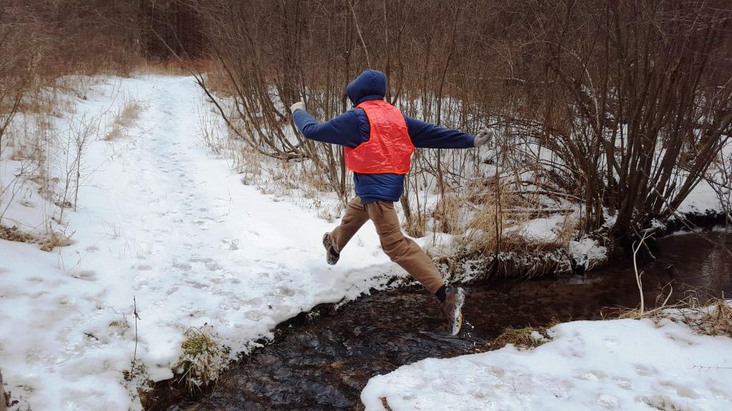
We found ourselves wishing we’d brought our spikes, but with a little care we had no problems. Sam even decided to leap across Murry Creek instead of using the footbridge where the trail crosses it.
The creek was running clear and quickly, fascinating Sam with the way it flowed under an icy roof over the creek just past the bridge.
We had a lively discussion about teenage stuff that even a clueless dad like me knows not to share in the newspaper, along with things like scouting and his plans for classes at high school next year. I was happy to learn he hoped to take an adventure education course with friends.
We also talked pop culture, regional history, and politics (he apparently has discovered the last could be an easy path to riches, power, and an everlasting ignominy that’s even worse than the one teenagers suffer).
It was a thorough pleasure to discuss adult topics with this young man who, when I started this column more than two years ago, conversed mostly about video-game characters on our first hike together that I chronicled.
Adult topics except politics, that is, which in the U.S. seem to have devolved into an immature, self-serving pastime. Sam could certainly do better than most politicians now – after all, he was a pirate in the play.
But unlike many of our so-called leaders, he understands the difference between fantasy and real life.
170 miles down, 950 to go
The Radley Creek Fishery Area includes 396 acres adjoining both Murry and Pearl Creeks, which join as the Radley and ultimately flow into the Waupaca River. The acreage includes open grass fields, pine plantations, remnant oak savanna, red and white pine plantations, oak woods, and marsh.
In season, the endangered Karner blue butterfly can be seen by lucky visitors, and the fishery is, of course, an integral part of the many fine trout waters of the Waupaca County area.
There are several routes to reach the parking area on Second Avenue, but it might be easiest for most potential visitors to search for “Belmont Town Office.” From the junction of 16th Road and Second Avenue, head east until just past Peacock Road. After Peacock, the road will bear slightly left and a small parking area will be on the right where the road bends.
Interestingly enough, Murry Creek is not an officially required part of the trail for a hiker to be considered a “Thousand Miler,” or someone who has completed all of the roughly 1,120 miles of the trail within Wisconsin.
Other IAT sections are part of Thousand-Miler requirements even though they also wander off of the generally directed path of the main trail, such as the one through the Merrill School Forest (which I wrote about last week).
There is a reason for this, according to the Ice Age Trail Alliance. The short explanation is that the trail once ran directly to the Merrill School Forest.
Tim Malzhan, director of trail operations for the alliance, told me by phone that a landowner revoked the handshake agreement the alliance had for access from that land to the school forest. What now seems an odd detour was once a fairly direct route.
Malzhan added that the Murry Creek segment was once blazed yellow as the rest of the trail was. It was, however, always an out-and-back segment, so the blazes have been switched to white and the segment is simply considered an extra part of the trail for Thousand Milers.
So Murry didn’t count as part of my own Thousand-Miler quest. But that’s OK, because having that particular stretch of soil – or ice – under my feet for a couple of hours with my son meant as much as all the time in the world.
*****
This post originally appeared in the Feb. 2, 2018, edition of The Portage County Gazette.
