
Wisconsin’s Ice Age Trail is unique for several reasons, including its lack of directness compared to most of the other 10 National Scenic Trails.
Its S-shaped path terminates in the east near Sturgeon Bay and in the west on the St. Croix River. Driving directly between each terminus would require a trip of about 320 miles. Yet the trail winds about for some 1,120 miles, plus an extra 80 or so for a bifurcation that occurs at Devil’s Lake State Park.
Only the North Country Trail, which runs 4,600 miles through eight states (including northern Wisconsin), comes close to the meandering nature of the Ice Age. But it is a relatively flattened S in comparison.
Most national trails look more or less like fairly direct lines from one end to another when viewed as a whole. For me, the wandering Ice Age is more charming. The trail beckons as a way of seeing our fine state rather than plowing through it from beginning to end.
That’s particularly so at Devil’s Lake. The trail approaches from Merrimac and Lake Wisconsin on the south, makes a half-loop around two massive bluffs and the lake itself, and splits on the north side of the park. One route heads north to Baraboo – a walk I wrote about in December – and the other almost completes the loop of the park and heads east toward Parfrey’s Glen and eventually Portage (walks I wrote about in December and June last year).
 You can almost imagine it as a long balloon with even longer strings at both ends. Twist the balloon as you would for an animal creation, crafting a two-part structure with the larger part being eight times as long as the shorter one, and your work would look like the Devil’s Lake hike and the two long bifurcating paths of the Ice Age, which eventually rejoin near Interstate 39 close to Westfield.
On a recent Saturday, my son and I were joined by frequent hiking buddy Chris Sadler, a former forensics coach from whom Sam wanted to learn tips for his junior-high debate class. We parked off of Wisconsin 113 where the Devil’s Lake Segment of the IAT ends and the Sauk Point Segment begins its path to Parfrey’s Glen.
Heading southwest along the Upland Trail, part of the park’s trail system, Sam and Chris also chatted about video games they like while I thought about more adult topics, such as whether I should write letters to some of our state legislators to call them boo-boo heads and picklebrains.
 We eventually came to the IAT, where we headed west along the park’s amazing south face of the East Bluff. It rises some 400 feet from the floor of the valley where once flowed the ancient Wisconsin River, according to one geological theory.
Massive talus slopes of quartzite angle out from the bluff, looking like big, squarish chunks of foam from a children’s play pit – but much larger and harder. From the cliffs above, it’s a little too easy to imagine your perch crumbling underfoot to add to the talus below.
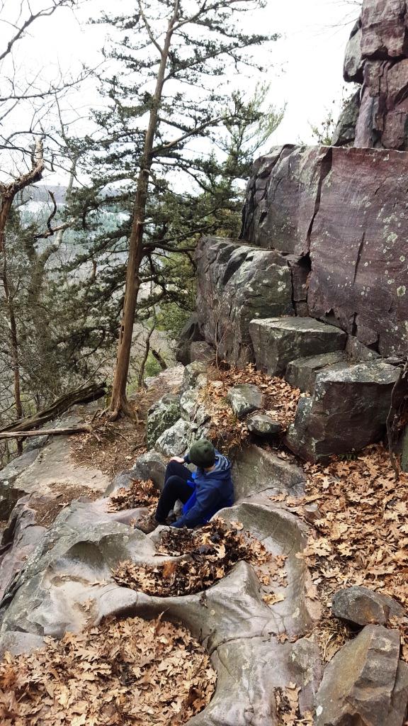
Despite temperatures in the 30s and gray skies, there were crowds of dogs on the trails with their owners in tow, as well as many other non-accompanied humans. We were impressed with the throngs on the bluff, especially as we climbed down the knee-grinding stone steps of the Potholes Trail, named for the wonderful bowl-like depressions in the stone, eroded out over the eons.
We saw a half-dozen rock climbers on an outcropping at the top of the Potholes, and we later passed a gaggle of apparent college students prepping for summer down at the lake by grilling, drinking beer, and playing cornhole in mittens, winter coats and stocking caps.
Reaching the other side of the lake, we trudged up the West Bluff. An elevation gain of about 450 feet marks the south end of the 1.4-mile West Bluff trail, with an equal drop on the north end.
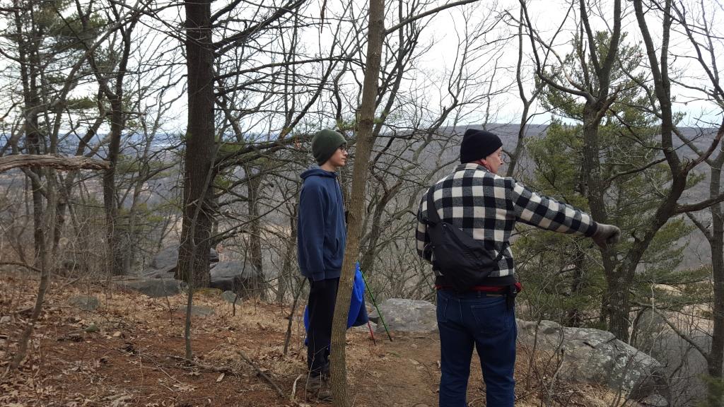 Views of the nearly oval lake below, hemmed in by the East, West, and South bluffs, were awe-inspiring from that height, just as the views had been from the East Bluff toward the rolling hills flowing southward toward Merrimac, Lodi, and Madison. Even without bright sun, the view there stretched for miles.
All told, we covered 9.5 miles of trail, including 8.6 of Ice Age Trail, and set foot on some 17 gazillion boulders of various sizes.
Sam, on his longest single-day hike to date, may have been slightly more worn out than the two old guys, although he recovered more quickly after our visit to Mama Mia in Baraboo, which Chris and I both consider the preeminent pizza we’ve had among several places near the Ice Age.
The best part is that I still haven’t finished either the last 2.3 miles of the IAT’s Devil’s Lake portion, nor about a mile of Sauk Ridge. Then there are still parts of both bifurcations for which a Devil’s Lake campsite would be the perfect base.
Like the views from the park’s bluffs, that’s a heavenly prospect, and I suspect I’ll wander back soon.
*****
This post originally appeared in the April 6, 2018, edition of The Portage County Gazette.
